

Archive Record
Images
Metadata
Collection |
Permanent |
Catalog Number |
R2006.013.631 |
Object Name |
Map |
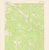
Title |
Panorama Peak Quadrangle |
Scope & Content |
Topographic map of Panorama Peak, Muggins Gulch, and Highway 36, Colorado. Published by the United States Geological Survey. Green and white. Panorama Peak Quadrangle. 7.5 minute series. |
Search Terms |
1970s Maps Panorama Peak |
Year Range from |
1978 |
Updated |
2023-03-15 |
Date |
1978 |